
Home · San Vito Lo Capo · How to get here
Plan your trip
How to get to San Vito Lo Capo
By plane, ship, car or coach: everything you need to reach the far north-western corner of Sicily.
Choose how to travel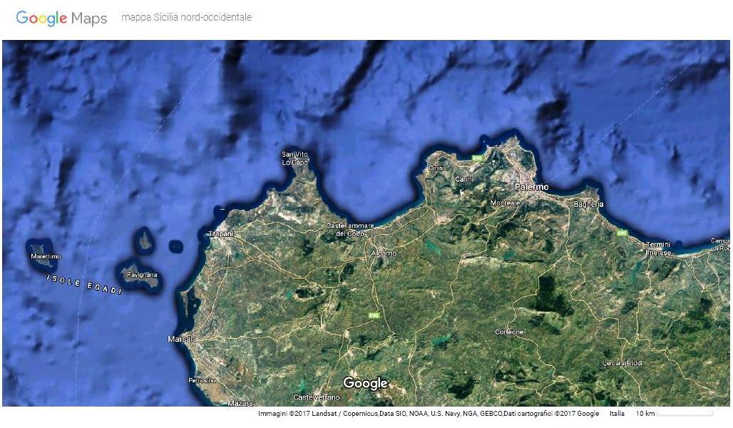
North-western Sicily · Google Map (google.it/maps)
By plane
The nearest airports
Two airports reachable by car or public transport.

By ship
The ports of Palermo and Trapani
Reachable by ferry, then by car or public transport.
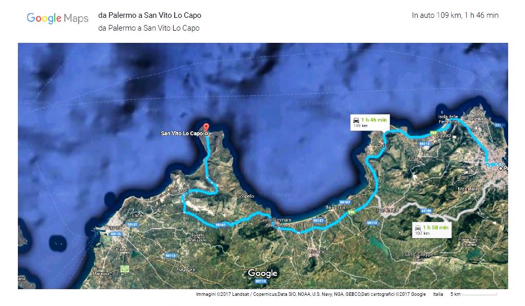
Port of Palermo
120 km from San Vito Lo Capo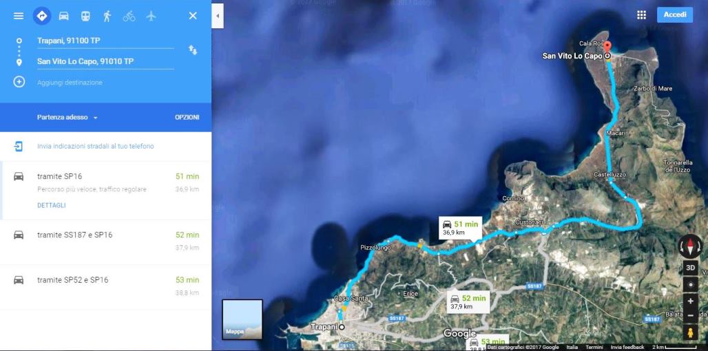
Port of Trapani
45 km from San Vito Lo CapoBy car
Road routes
The recommended itineraries from Palermo and from Trapani.
From Palermo
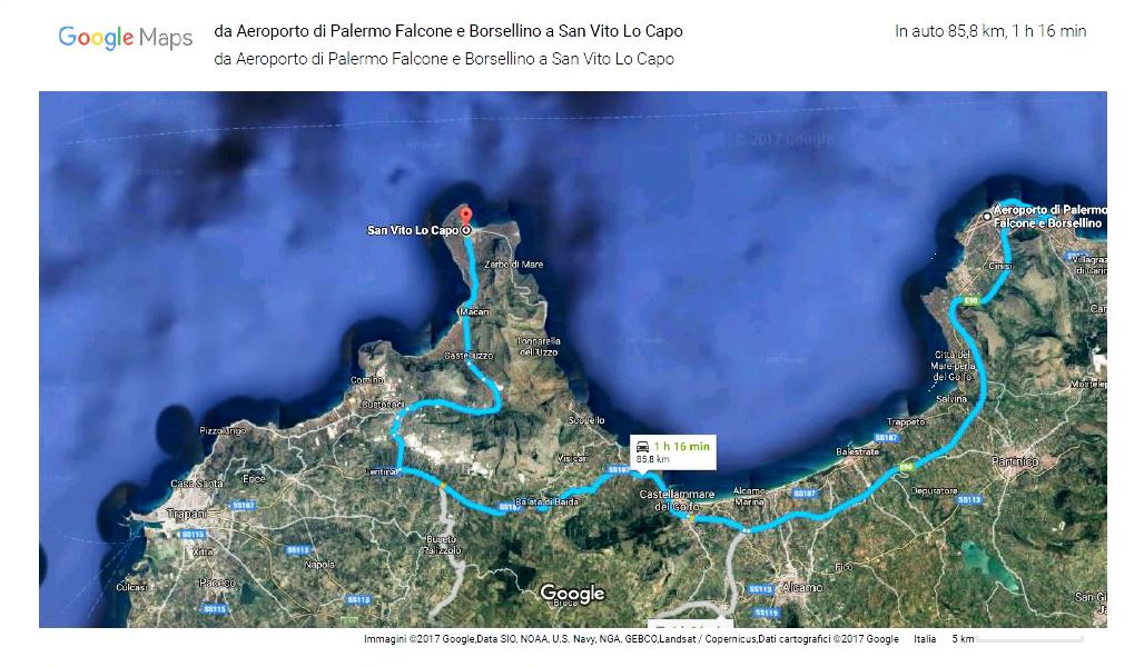
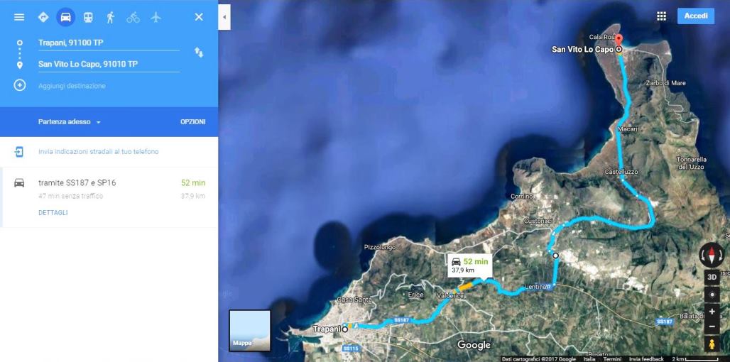
A29 motorway (Palermo – Mazara del Vallo), exit Castellammare del Golfo (45 km). Then SS 187 towards San Vito Lo Capo, exit at the “Lentina” junction, join SP 16 and follow the signs for San Vito Lo Capo.
From Trapani (SS 187)
SS 187 towards San Vito Lo Capo, exit at the “Lentina” junction, join SP 16 and follow the signs for San Vito Lo Capo.
From Trapani (SP 21)
SP 21 towards San Vito Lo Capo, exit at the “Custonaci” junction, join SP 16 and follow the signs for San Vito Lo Capo.
By coach and public transport
Bus services
Connections with Palermo and Trapani; timetables are shown in the images.
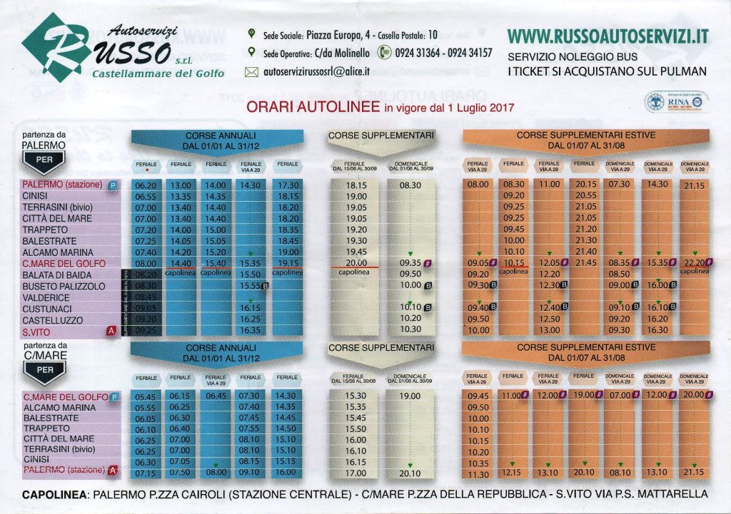
From Palermo to San Vito Lo Capo
Russo bus services, tel. +39 0924 31364. Website →
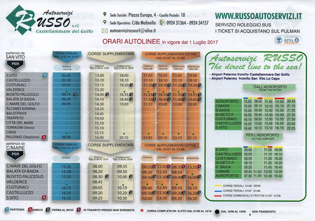
From San Vito Lo Capo to Palermo
Russo bus services, tel. +39 0924 31364. Website →
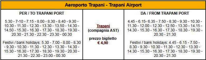
From Birgi airport to Trapani
AST (Azienda Siciliana Trasporti), tel. +39 0923 23222. Website →
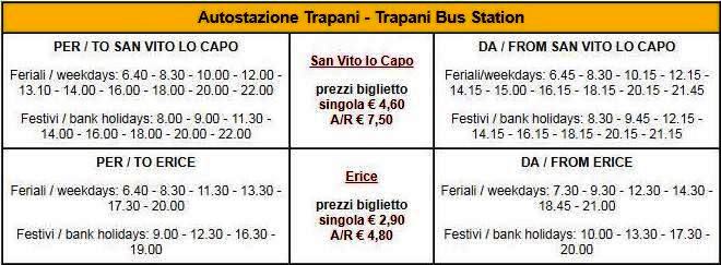
From Trapani to San Vito Lo Capo
AST (Azienda Siciliana Trasporti), tel. +39 0923 23222. Website →
Have you already decided to go?
Choose your home in San Vito Lo Capo.
Ask us for availability and a quote: we will also help you with directions for your arrival.
Explore the homes